Togo
Savannah region, central
region and plateaus
6
partenaires
5,899
people impacted in 2025
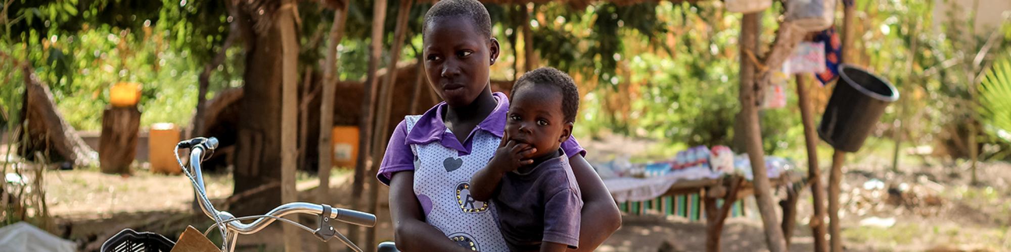
Louvain Cooperation in Togo


Partners and donors
- Research, Support and Training for Self-Development Initiatives: RAFIA
- Union of Mutual Savings and Credit Funds in the Savanes Region: UCMECS
- Association for the Support of Community Health Activities: 3ASC
- National Framework for Consultation on Mutual Insurance in Togo: CNCMUT
- Union of Social Mutual Insurance Funds in the Central and Plateau Regions of Togo: UMUS-CP
- Union of Health Mutual Insurance Funds in the Savanes Region: UMUSAS


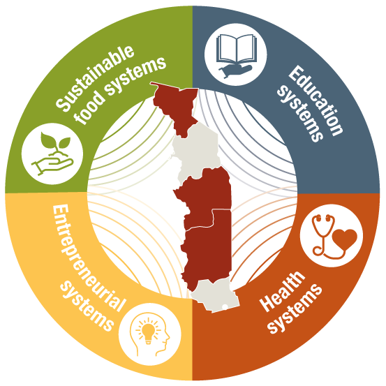
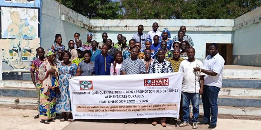
Promoting access to healthcare/h1>- Project duration : 2022-2026
Our objective
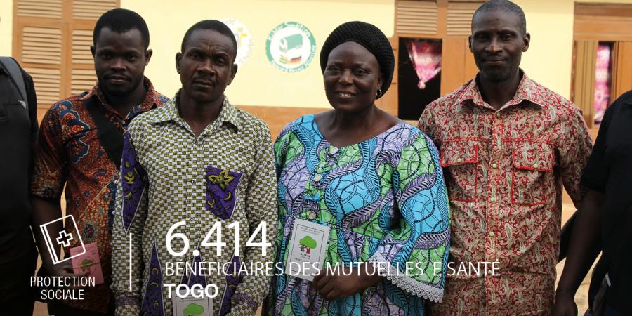
To facilitate access to quality healthcare for rural populations and workers in the informal sector by supporting the operational development of mutual insurance and social protection at the community, regional and national levels. This project contributes to Universal Health Coverage, protecting individuals from social risks that could push them into poverty.
Our actions
- Participation in the operationalisation of the National Social Protection in Health Policy (PSS) by supporting national mutualist movement platforms;
- Advocacy for the inclusion of the mutualist movement in the Universal Health Coverage scheme set up by the State;
- Strengthening and structuring the mutualist movement and contributing to the harmonisation of practices at the national level;
- Strengthening mutual insurance unions and federations by developing technical capacities (digitalisation, use of ICT, etc.);
- Liaising with social and solidarity economy initiatives to facilitate group membership of mutual societies for their members;
- Improving the quality of care in approved health centres;
- Raising awareness of the prevention of communicable diseases (malaria, HIV, etc.) and non-communicable diseases (diabetes, hypertension, breast and cervical cancer, etc.);
- Promoting good health practices in rural communities;
Our impact
This project enables vulnerable households, who are often forced to finance their own healthcare, to access quality care throughout the year, prevent catastrophic healthcare expenditure, and strengthen their socio-economic resilience.


The context of Togo
A country rich in diversity, but facing many challenges
Although it is one of the smallest countries in West Africa, Togo stands out for its diverse landscapes, rich cultural heritage, renowned traditional cuisine and the warm hospitality of its people. The country also has significant mineral and agricultural resources and benefits from a strategic location thanks to the port of Lomé.
However, despite these strengths, poverty and social inequality remain a concern:
- 53% of the population lives on less than €2 per day.
- Women are particularly affected: 45% of adult women are illiterate (World Bank, 2019).
An economy that is still largely rural
- 65% of the working population is employed in the agricultural sector.
- 60% of the country's land area is arable.
- Agriculture remains essentially subsistence-based, highly dependent on the seasons and vulnerable to climate change.
Significant inequalities in access to healthcare
- Only 8.4% of the population has health insurance (2017).
- The healthcare system remains fragile, with limited access in rural areas.
- The maternal mortality rate is high: 399 deaths per 100,000 live births (2020).
- 23% of children under the age of 5 suffer from stunted growth due to malnutrition.
Access to education still insufficient for women
- Despite progress, illiteracy remains high among adult women: 45% (2019).
- Disparities between urban and rural areas persist.
- Girls often drop out of school due to early marriage, poverty or lack of infrastructure.

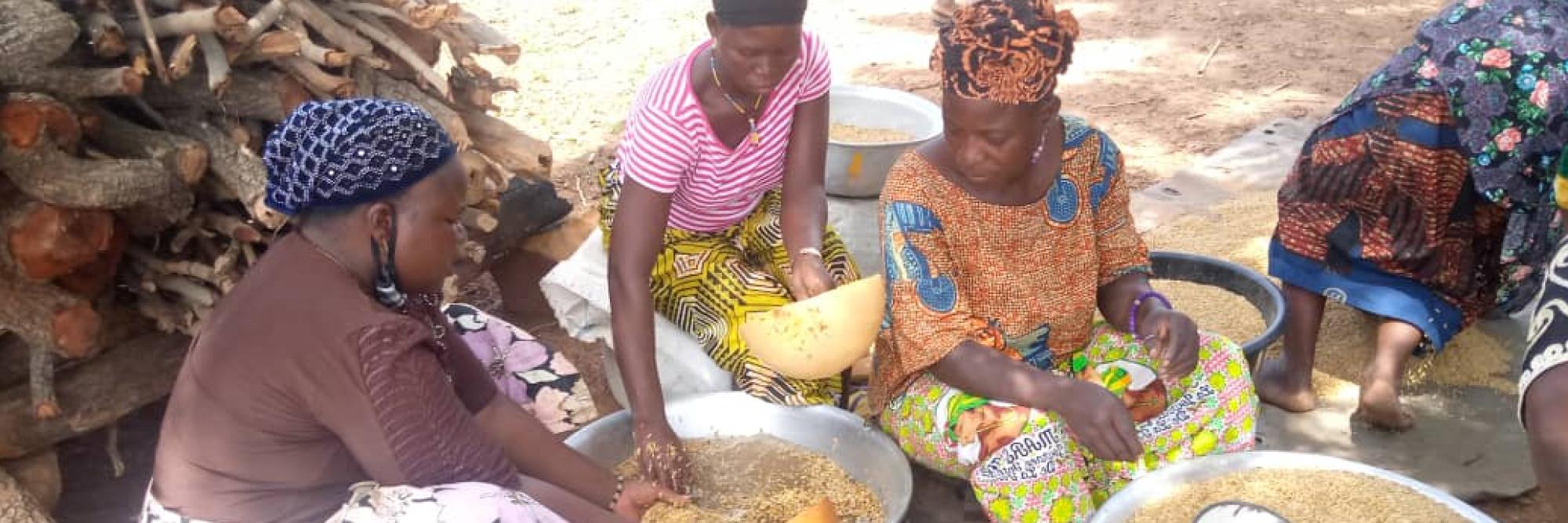
Transition to sustainable and inclusive food systems
- Project duration : 2022-2026
Our objective:
To support agricultural entrepreneurs and rural communities in the Savanes Region in their transition to sustainable food systems. This involves strengthening their individual and collective capacities to enable them to fully exercise their economic, social, cultural and environmental rights, while integrating gender equality at the heart of every action.
Our actions
- Training for agricultural entrepreneurs and producers to strengthen technical skills and promote sustainable farm management;
- Practical workshops on innovative marketing and food hygiene;
- Integration of livestock farming into agriculture;
- Deployment and strengthening of the Participatory Guarantee System (PGS) for the certification of locally produced agroecological products;
- Creation of an online platform, EcoAgriMarket, for the sale of local agroecological products;
- Assessment and support for the agroecological transition of around 100 farms;
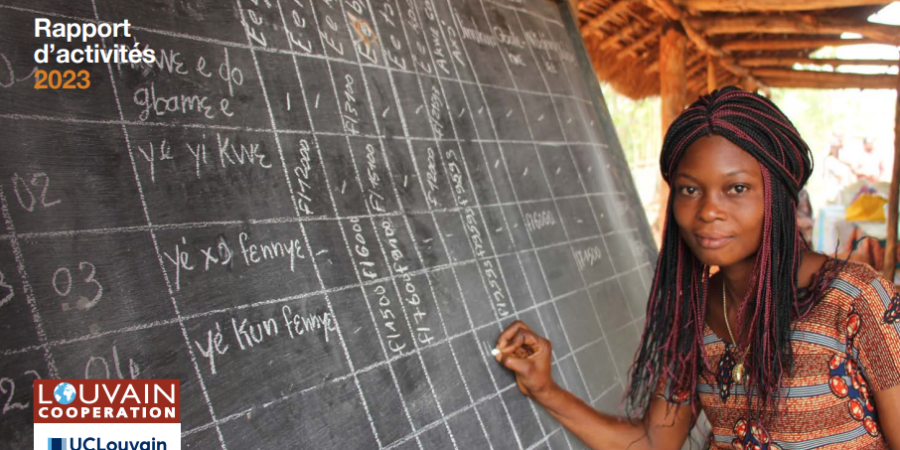
- Implementation of a literacy programme using the Reflect method (Regenerated Freirean Literacy through Community Techniques) comprising eight literacy centres, mainly for women;
- Facilitation of community reading, writing and listening clubs.
Our impact
This project enables agricultural producers and entrepreneurs to strengthen their skills, increase their incomes and better promote their products, while promoting the economic inclusion of women and the resilience of rural communities.
Contact : info-ao@louvaincooperation.org
Find out more about our activities in Togo
Toutes les vidéos du Togo +
FAQ
Trade is centred around the port of Lomé and a north–south road linking the capital to Burkina Faso and, beyond that, to the Sahel.
To the east and west, major roads ensure trade flows with Benin and Ghana.
In rural areas, tracks connect markets, production areas and service centres. The rainy seasons can slow down some journeys, making maintenance of infrastructure (bridges, gutters) and road information crucial.
- South: port, logistics zones, market gardening belt and short supply chains to Lomé.
- Centre: agricultural plateaus and links to domestic markets.
- North: savannahs, livestock farming and passage to regional Sahelian corridors.
Togo's population is growing and predominantly young.
Urbanisation is progressing rapidly, with a high concentration of population, jobs and services in Lomé and a network of regional cities (Kara, Sokodé, Atakpamé, Kpalimé, Dapaong).
This dynamic poses challenges in terms of access to water and sanitation, waste management, urban transport and the professional integration of young people, while supporting the emergence of new services and activities.
The challenges vary depending on the environment: coastal erosion and submersion in some coastal areas, soil degradation due to erosion or depletion, pressure on forests and forest galleries, seasonal flooding in low-lying areas (valley bottoms and floodplains) and droughts further north.
The responses to these challenges combine flexible coastal protection measures (sediment replenishment, restoration of mangroves or dune ridges), anti-erosion developments (ridges, hedges, grass strips), appropriate water management (small reservoirs, drainage, canal maintenance) and agroforestry.
With a view to sustainable livelihoods, sustainable food systems aim to diversify crops, improve organic fertility, reduce losses and strengthen the resilience of farms.
On the coast, erosion and submersion threaten certain localities; in the plains and lowlands, flooding can occur during the rainy season, while the savannahs of the north face episodes of drought and bush fires. Preparedness measures combine hazard mapping, maintenance of structures (dykes, weirs, gutters), warning systems and land use planning to limit exposure to risks. Risk education and targeted social protection strengthen the adaptive capacity of Togolese households.
The country is home to a mosaic of forests, savannahs and wetlands.
Parks and reserves protect these environments, notably Fazao–Malfakassa (forest massifs and upland wildlife), Kéran–Oti–Mandouri and Togodo (gallery forests, floodplains, birdlife).
The challenges relate to habitat fragmentation, pressure on wood energy and wildlife, and fire management; the response involves participatory management, habitat restoration and more sustainable energy alternatives.
The climate is tropical, with alternating dry and wet seasons.
The south often experiences two rainy seasons (spring–early summer and late winter), while the north alternates between a marked rainy season and a longer dry season.
The dry, dusty Harmattan continental wind blows during the dry season and can reduce visibility and affect respiratory health. Agricultural calendars, water availability and road conditions are adjusted to these rhythms.
This is a method of production that protects the soil and water while securing families' incomes. In practical terms, the soil is covered between two crops (plant cover, mulching) to prevent erosion, crops are alternated from one season to the next (maize or sorghum, then legumes such as cowpeas, then roots/tubers) to maintain fertility, and seeds are sown along contour lines to slow down rain runoff.
- Protect the soil : plant cover and mulching to limit erosion and retain moisture.
- Alternate and diversify : maize/sorghum–legume–root crop rotations to nourish the soil and reduce pests.
- Manage water : small reservoirs, infiltration channels, simple drainage in low-lying areas (valley bottoms) to store useful water and prevent flooding.
- Combine useful trees: shea and néré parks, multi-species hedgerows that provide shade, fruit/seeds, wood energy and improve fertility.
The result: more consistent harvests despite the seasons, more vibrant soils and greater local added value thanks to small-scale processing (flour, oils, dried fruit). This approach is part of agroecology and sustainable food systems, adapted to Togo's coastal and savannah environments.
French is the official language. Widely spoken national languages (notably Ewe in the south and Kabyè in the north) coexist with other dialects depending on the region. Social life is rooted in markets, festivals and chiefdoms, with a variety of cultural expressions: weaving and dyeing, percussion and singing, and local rituals. Emblematic events such as the Evala fights (Kara region) illustrate the role of traditions in Togolese cohesion.
Togo is a country in West Africa, bordered by Ghana to the west, Benin to the east, Burkina Faso to the north and the Atlantic Ocean to the south.
Its territory, narrow from south to north, is centred around a lagoon coastline (Lomé, Aného), a coastal plain and wooded and cultivated plateaus (Plateaux and Central regions), giving way further north to savannahs (Kara, Savanes).
Lakes and lagoons (including Lake Togo) and large transboundary rivers (Mono, Oti) shape land use, support inland fisheries and facilitate travel.
From the lagoon coastline (Lomé, Aného) to the mountains and forests of Kpalimé, from the waterfalls and massifs of the Plateaux to the savannahs of the north, the country offers a variety of environments.
Koutammakou, the ‘land of the Batammariba’ and a UNESCO World Heritage Site, is a living cultural landscape where the famous tatas (tower houses made of raw earth) are organised into hamlets with granaries, enclosures and altars, in the heart of the savannahs and hills. Built of banco, laterite and wood, then plastered and decorated, these structures bear witness to skills passed down from generation to generation and a way of living that combines protection, crop storage, social organisation and agricultural rhythms. They continue to evolve today: seasonal repairs, adaptation to rain and wind, occasional integration of contemporary materials; all while being the subject of conservation and transmission initiatives.
The economy combines family farming (maize, cassava, sorghum, yams; coffee, cocoa and oil palms in wet areas), livestock farming (small ruminants and poultry, more prevalent in the north) and freshwater fishing in the lakes and lagoons of the south.
The country has mineral resources, particularly phosphates, and relies on the Autonomous Port of Lomé, a deep-water port and transhipment hub that connects Togo to regional and international markets.
Services (trade, finance, telecommunications, business and leisure tourism) are growing in importance, supported by road corridors to the hinterland (the interior).